
To support Hong Kong’s economic development, the Government steers the transformation of Kowloon East (KE) into another attractive core business district. To bring this vision to fruition, the Conceptual Master Plan (CMP) 5.0 promulgated by the Energizing Kowloon East Office (EKEO) focuses on Walkability and Mobility, Green CBD, Smart City, Socio-economic Vibrancy and the Spirit of Creation.
Building on the momentum of the transformation in KE, it was announced in the Policy Agenda in October 2017 that the Energizing Kowloon East (EKE) initiative would be extended to San Po Kong, covering an area of about 26 hectares. EKEO is working with the relevant government bureaux/departments to review the opportunities and issues pertaining to the San Po Kong Business Area (SPKBA), with particular emphasis on enhancing connectivity, improving the environment, promoting vibrancy and diversified development. In February 2018, EKEO commissioned the San Po Kong Business Area Pedestrian Environment and Traffic Improvement - Feasibility Study (the Study).
Taking account of public aspirations for improving the pedestrian environment and traffic conditions in SPKBA as well as the planning vision for new and planned developments in the area, the objectives of the Study are:
We make good use of SPKBA’s existing facilities and introduce enhancements by deploying suitable measures to create a better pedestrian environment while bringing improvements to the traffic conditions at the same time. Specifically, the pedestrian environment should be:
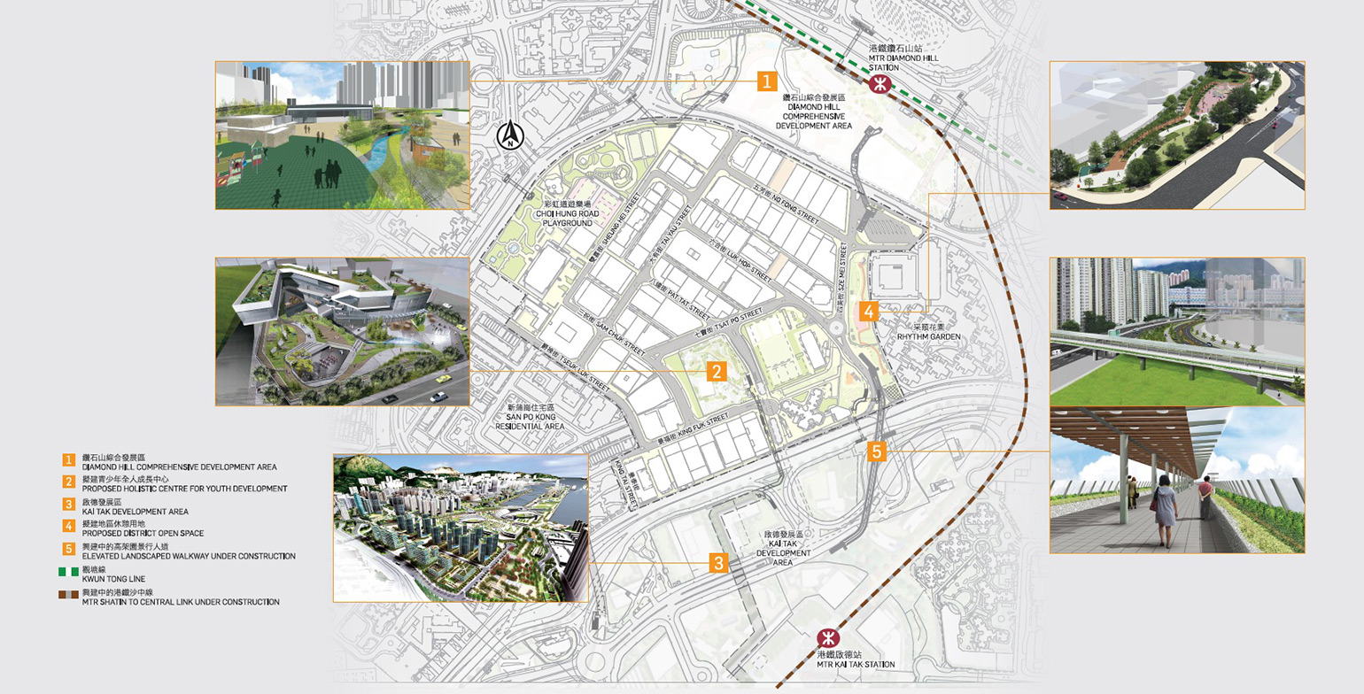
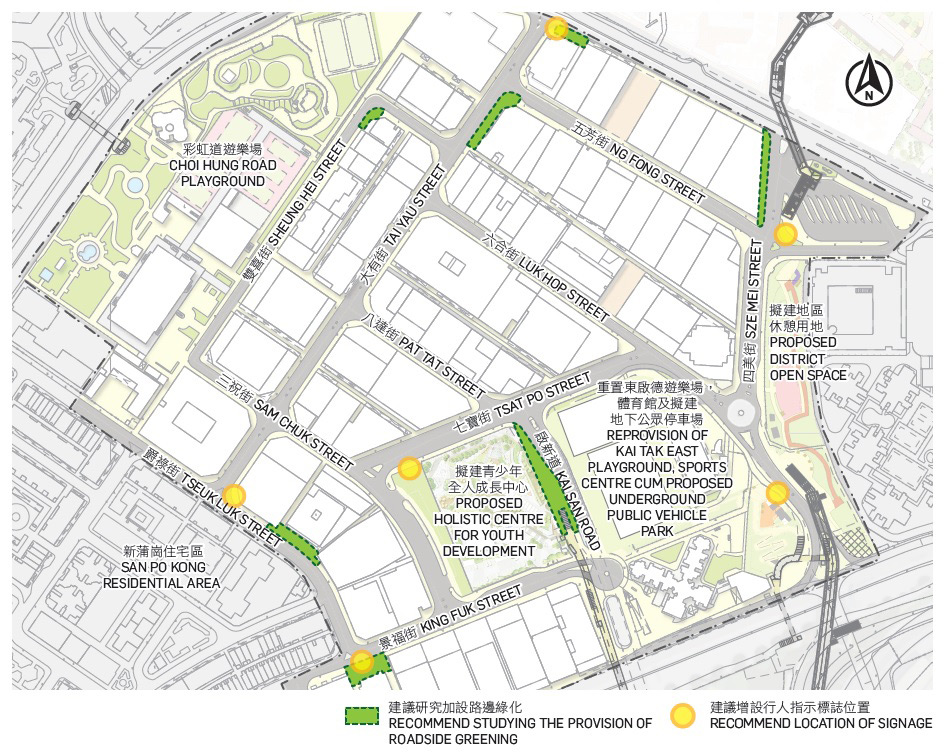
In addition to burgeoning business activities and other new/planned developments in SPKBA, the area is anticipated to form closer ties with the surrounding neighbourhoods. Synergy effects generated by the Kai Tak Development Area (KTDA), the Diamond Hill Comprehensive Development Area, the proposed district open space in the Sze Mei Street area, the proposed Holistic Centre for Youth Development, and the Choi Hung Road Playground Redevelopment etc. will promote and contribute to the transformation of SPKBA. These opportunities should be captured in formulating the overall improvement framework.
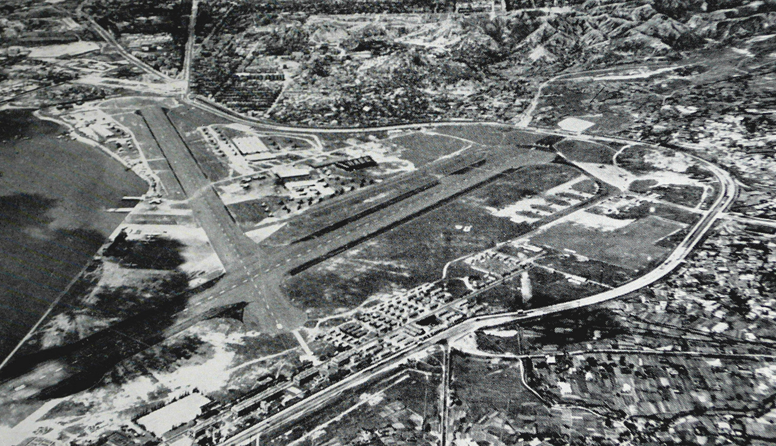
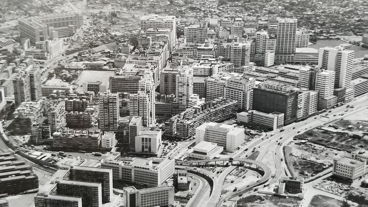
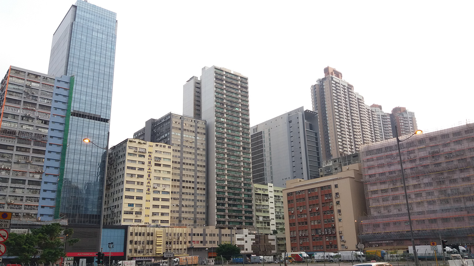
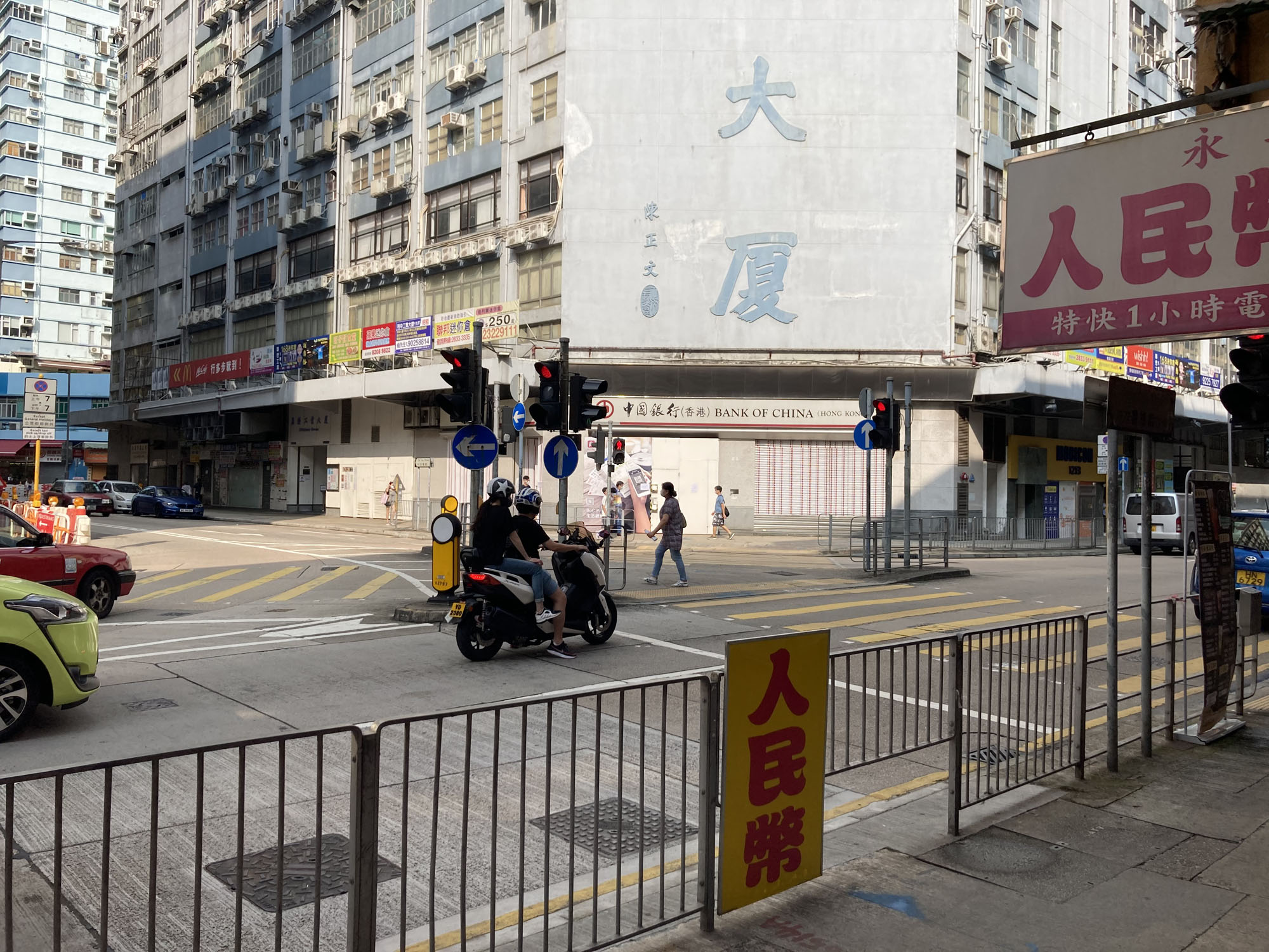
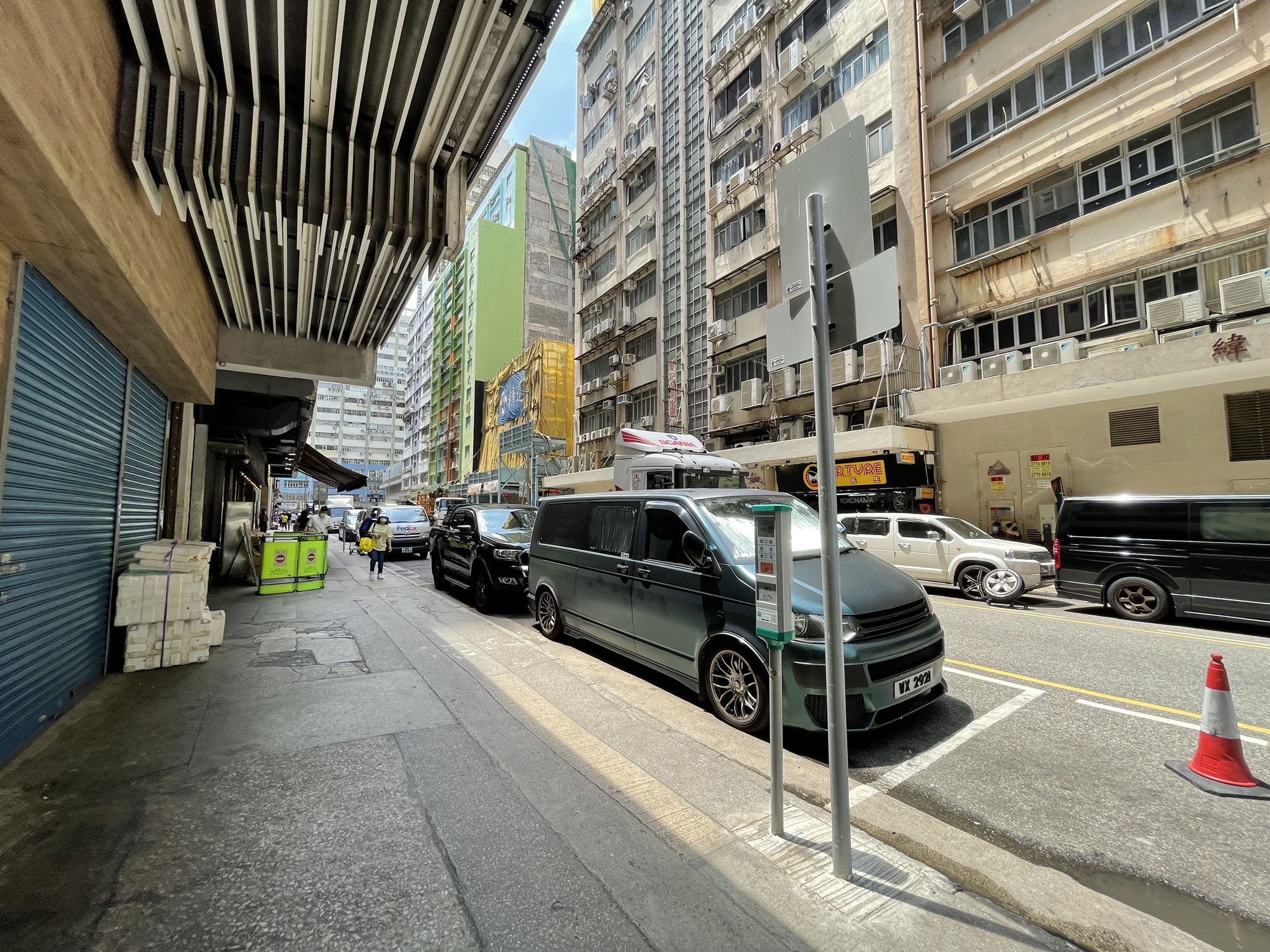
SPKBA used to be an industrial area but it is now undergoing gradual transformation to business uses. Some existing facilities in SPKBA are no longer able to cater for the needs of SPKBA. The key challenges include:
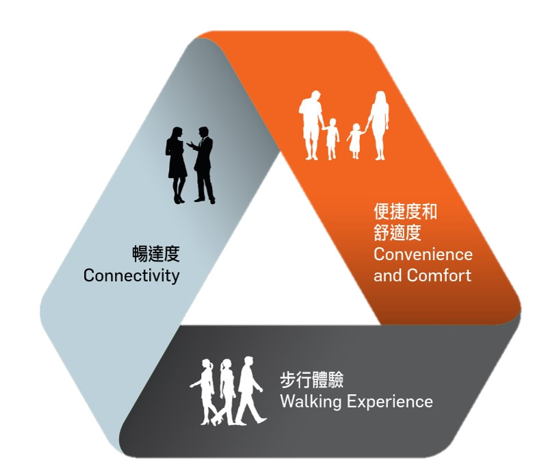
A “people-oriented” approach is adopted in formulating the pedestrian environment improvement framework which includes three key improvement strategies:
Enhancing pedestrian connectivity – through improving existing pedestrian facilities or introducing smart measures to reduce pedestrian-vehicular conflicts, thus creating a more convenient, safer and barrier-free walking environment.
Improving convenience and comfort – through seamless connections to MTR stations and activity nodes/destinations, and creating more public spaces to help provide a better pedestrian environment
Improving walking experience – to promote walking through providing more greening, enhancing streetscape and integrating with points of interest (e.g. retail, community facilities and open space, etc.) to bring about an inviting, interesting and healthy walking experience.
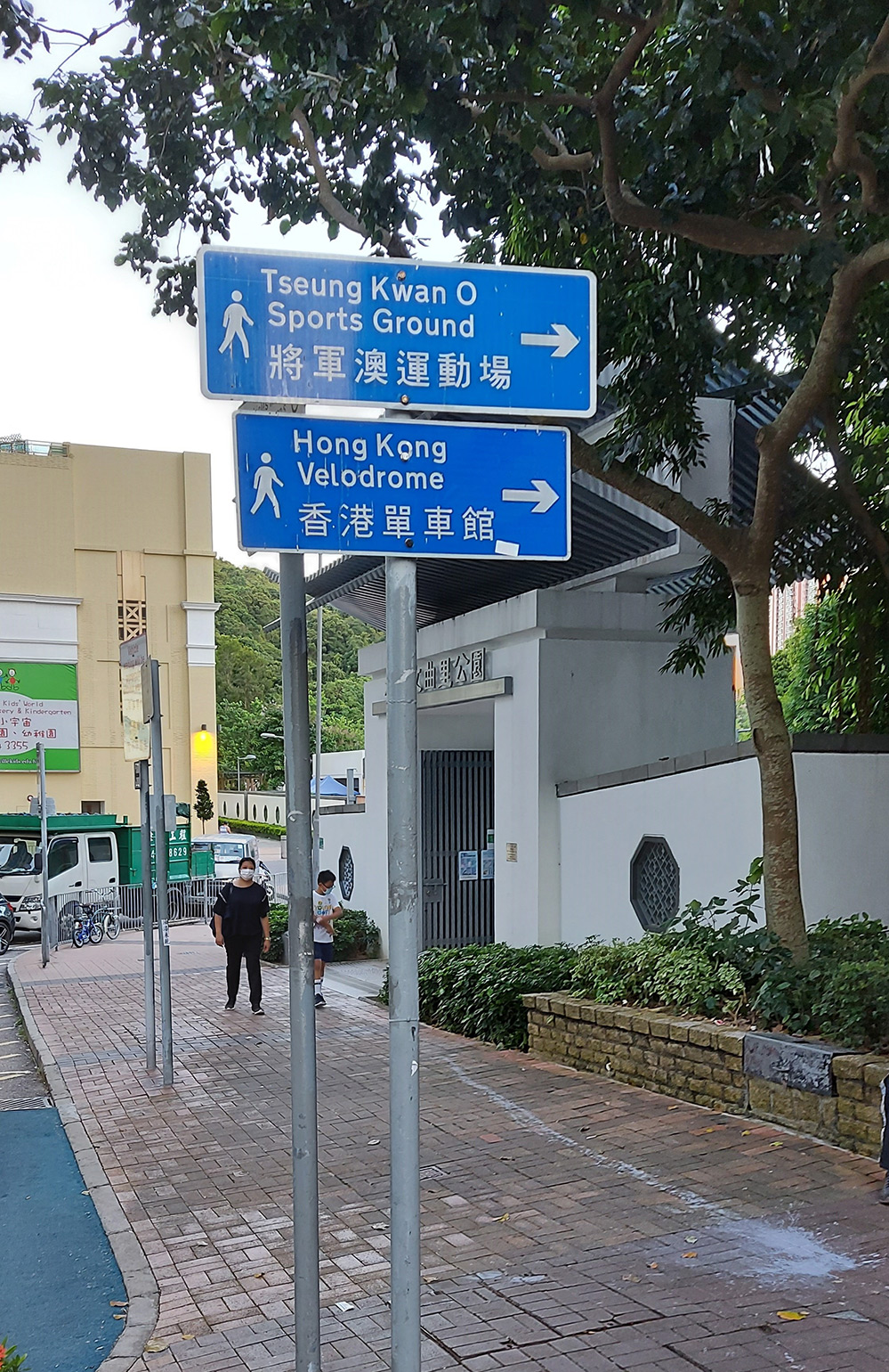
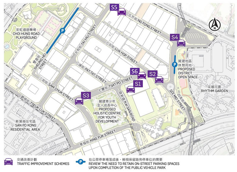
Three north-south corridors namely Tai Yau Link, Sze Mei Link and Sam Chuk Link are identified as the key pedestrian routes which traverse through various commercial and community nodes within SPKBA and linking the adjacent key development areas, namely the Diamond Hill Comprehensive Development Area to the north and the KTDA to the south via the existing and proposed pedestrian links.
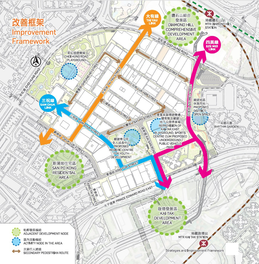
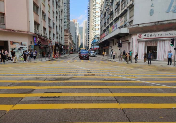
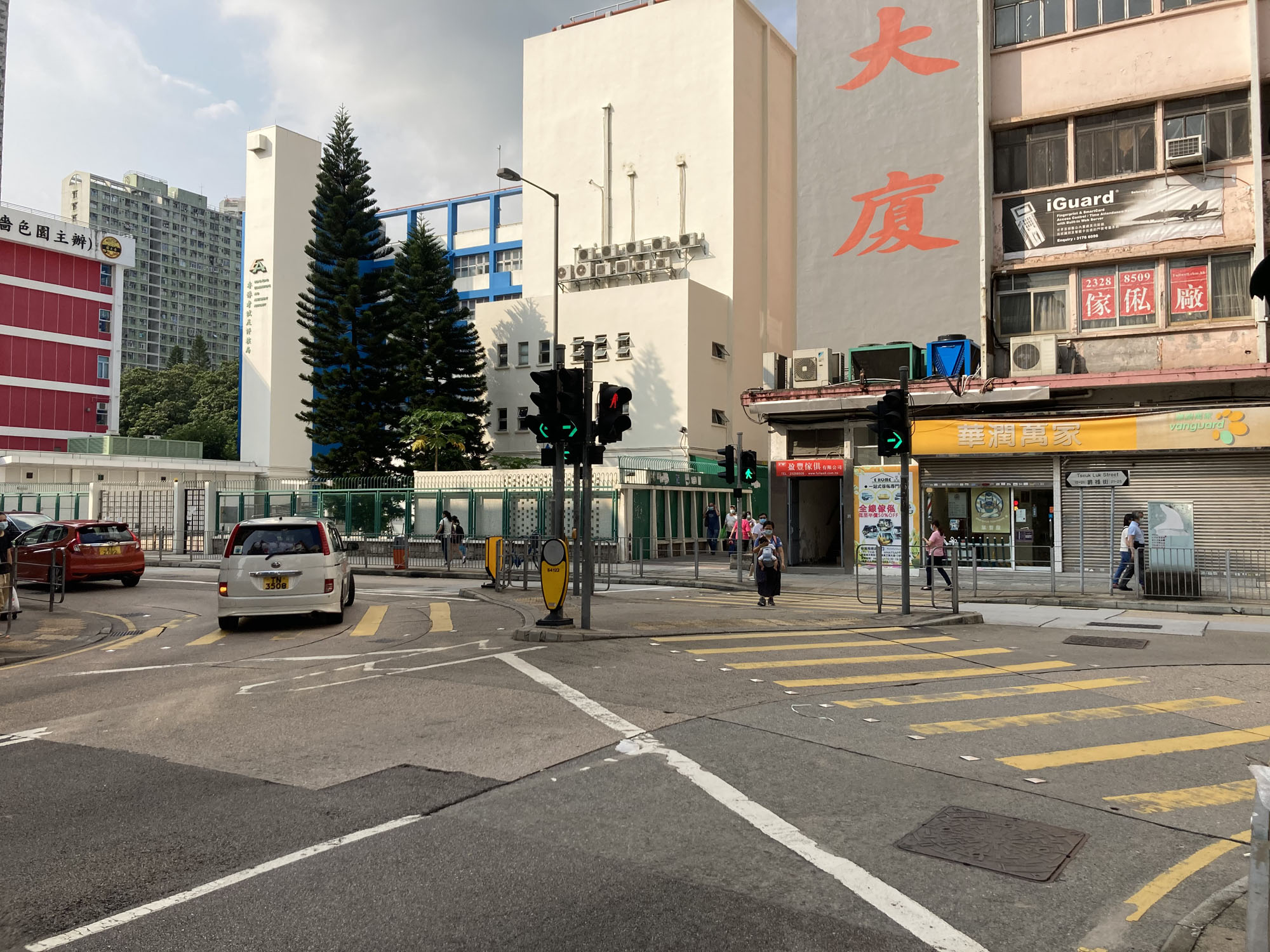
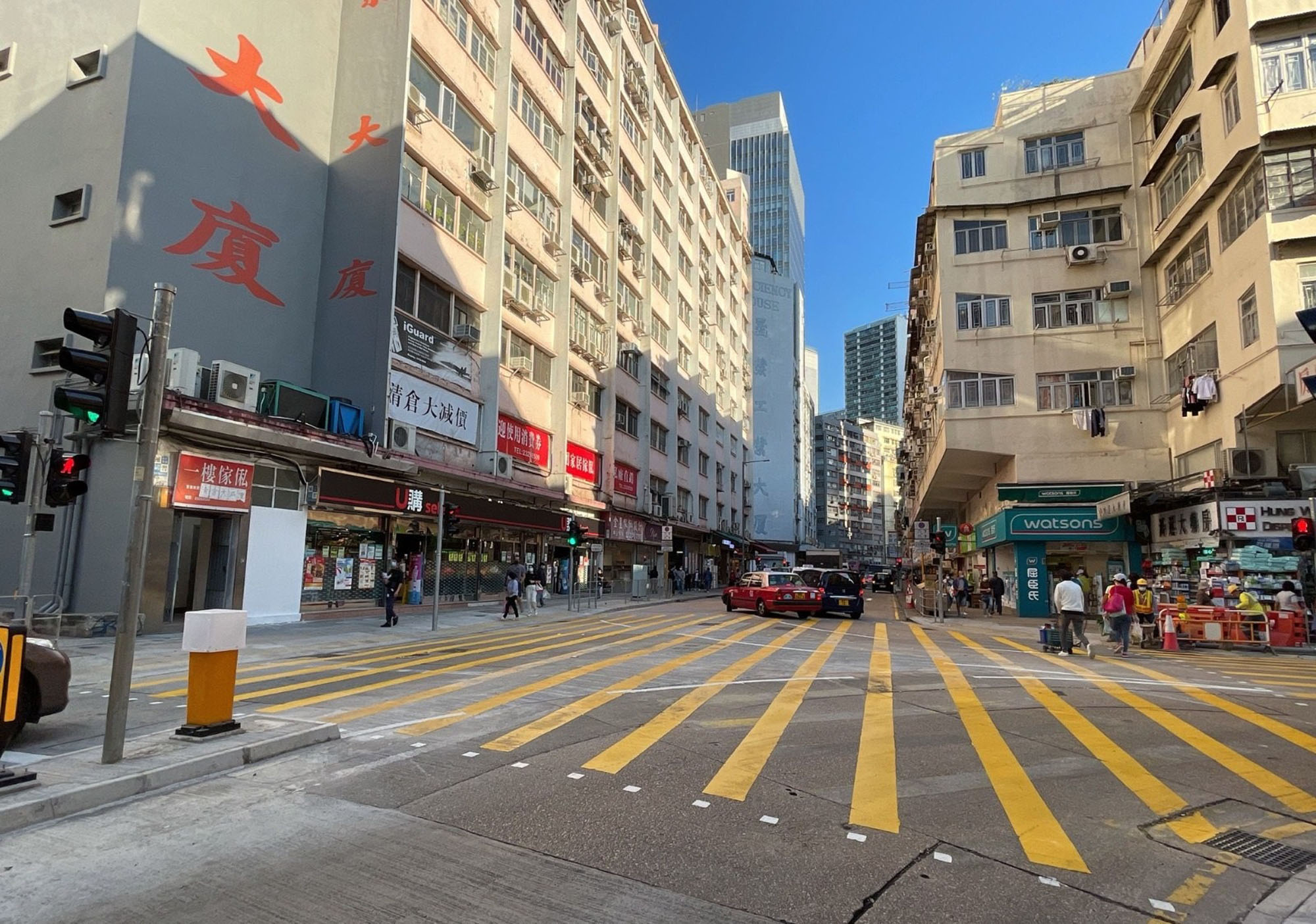
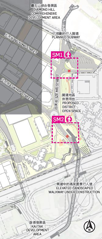
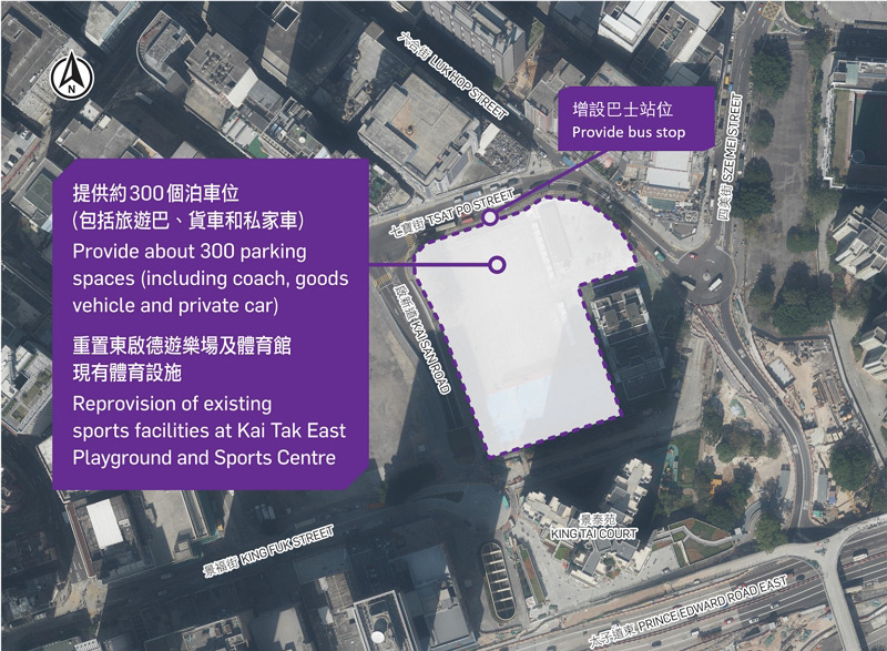
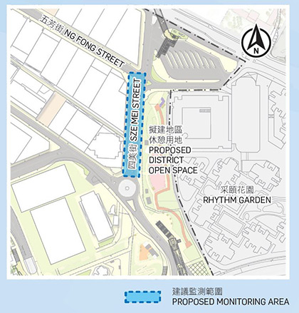
Tai Yau Street and Sze Mei Street are the key traffic corridors in the area linking the SPKBA and adjacent major roads, namely Choi Hung Road to the north and Prince Edward Road East, Kai San Road and Tseuk Luk Street to the south. Relocation of the Kai Tak East Playground and Sports Centre will provide opportunity to enhance traffic capacity at Sze Mei Street and the adjacent road junctions, and to provide underground public vehicle park.
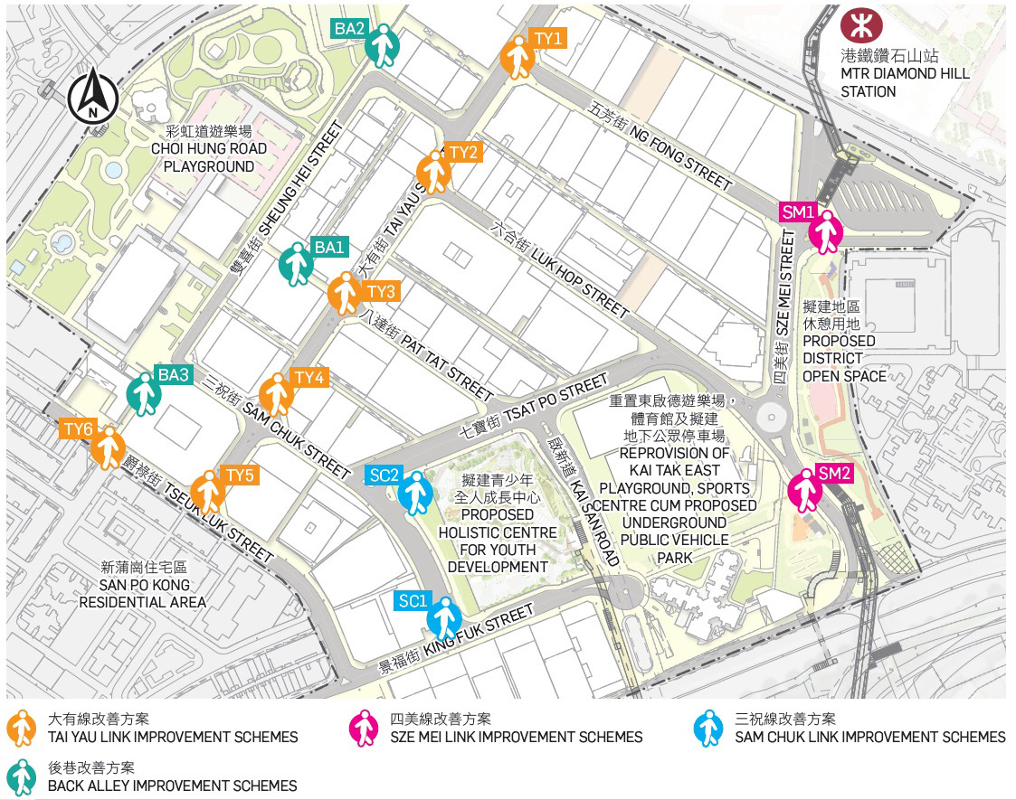
We recommend enhancing the pedestrian environment through improving accessibility and safety for pedestrians. The following enhancement schemes along each link are proposed.
Tai Yau Street is a major thoroughfare between the Diamond Hill Comprehensive Development Area and the San Po Kong Residential Area. Pedestrian flow is expected to increase further.
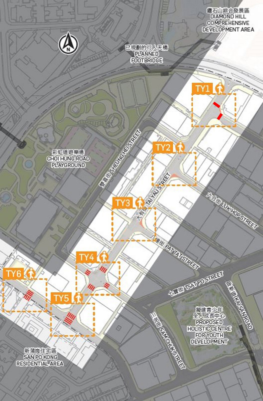
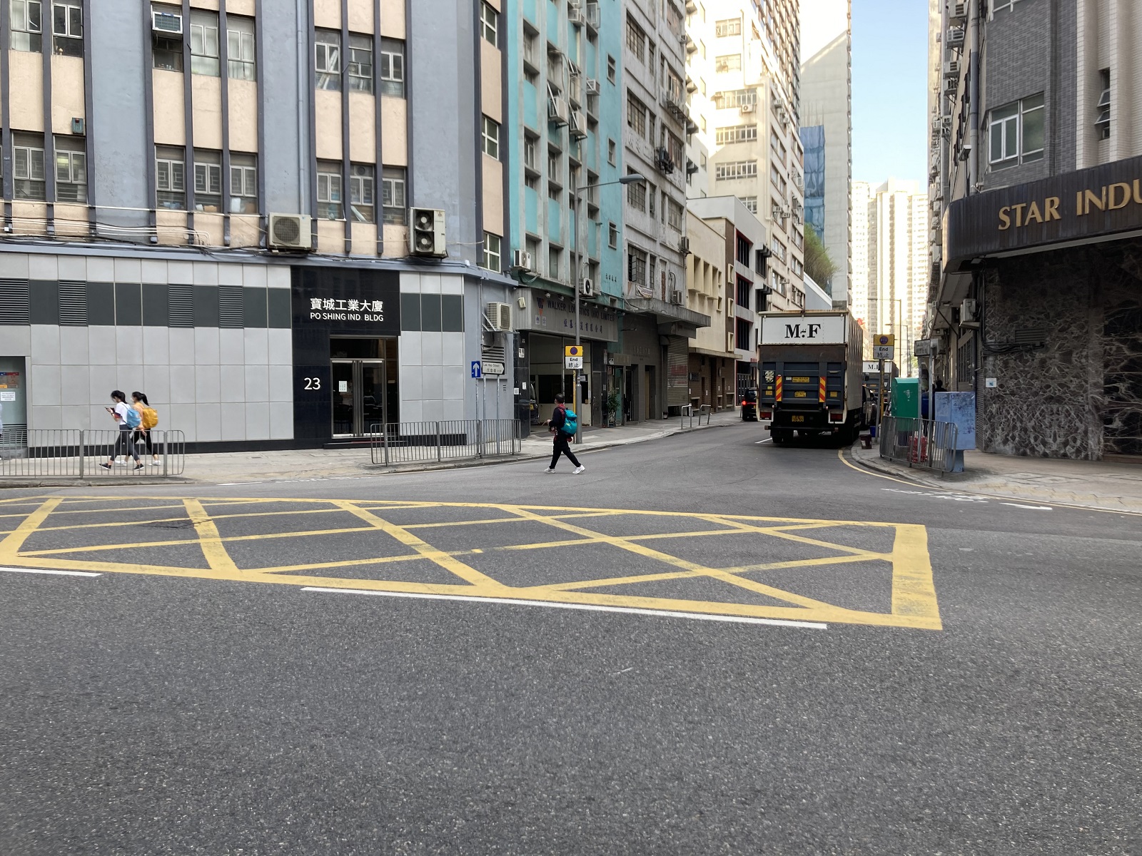
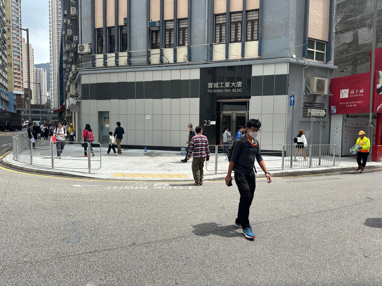
We propose to optimize Tai Yau Street and its connecting roads by improving the junctions, enhancing the streetscape and the pedestrian links at the northern and southern ends.
Sze Mei Link is the shortest route to the KTDA from Choi Hung Road, MTR Diamond Hill Station and nearby residential areas. With the progressive development at KTDA and more commercial buildings coming into place, Sze Mei Link is expected to become a busy pedestrian thoroughfare in the district.
The existing pedestrian subway across Prince Edward Road East and the elevated landscaped walkway under construction, together with the planned pedestrian subway in the Diamond Hill Comprehensive Development Area, will provide excellent pedestrian linkage at the northern and southern ends. We will leverage the opportunities arising from the development of the Sze Mei Street district open space to create a pleasant and coherent green urban space in the Sze Mei Street area and connect the activity nodes. We also recommend widening pedestrian crossings along the route to rationalize pedestrian and vehicular traffic.
Sam Chuk Street is one of the key links to Choi Hung Road Playground. It also links up with the future Holistic Centre for Youth Development and connects with the pedestrian subway at Prince Edward Road East via King Fuk Street.

We recommend transforming Sam Chuk Street into a vibrant pedestrian passageway by improving connectivity at junctions. We also recommend making use of the future public open space adjoining the Holistic Centre for Youth Development to make the Link more “stayable”, and at the same time providing a convenient access to the future focal point for young people.
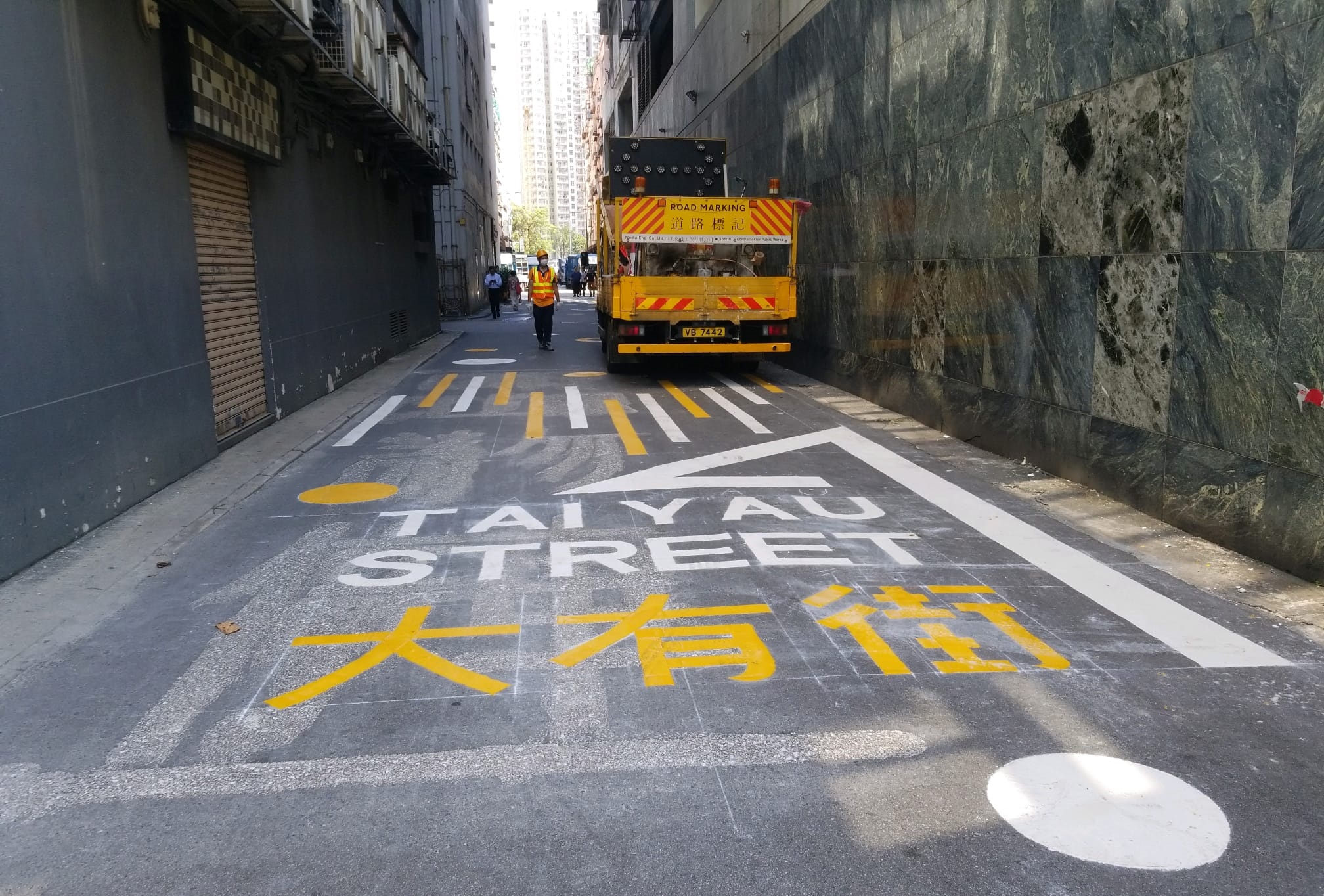
With an in-depth analysis of the existing conditions of the back alleys in SPKBA, we propose to transform suitable back alleys into more attractive and safe pedestrian routes to become part of the pedestrian network.
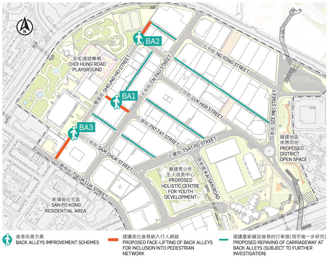
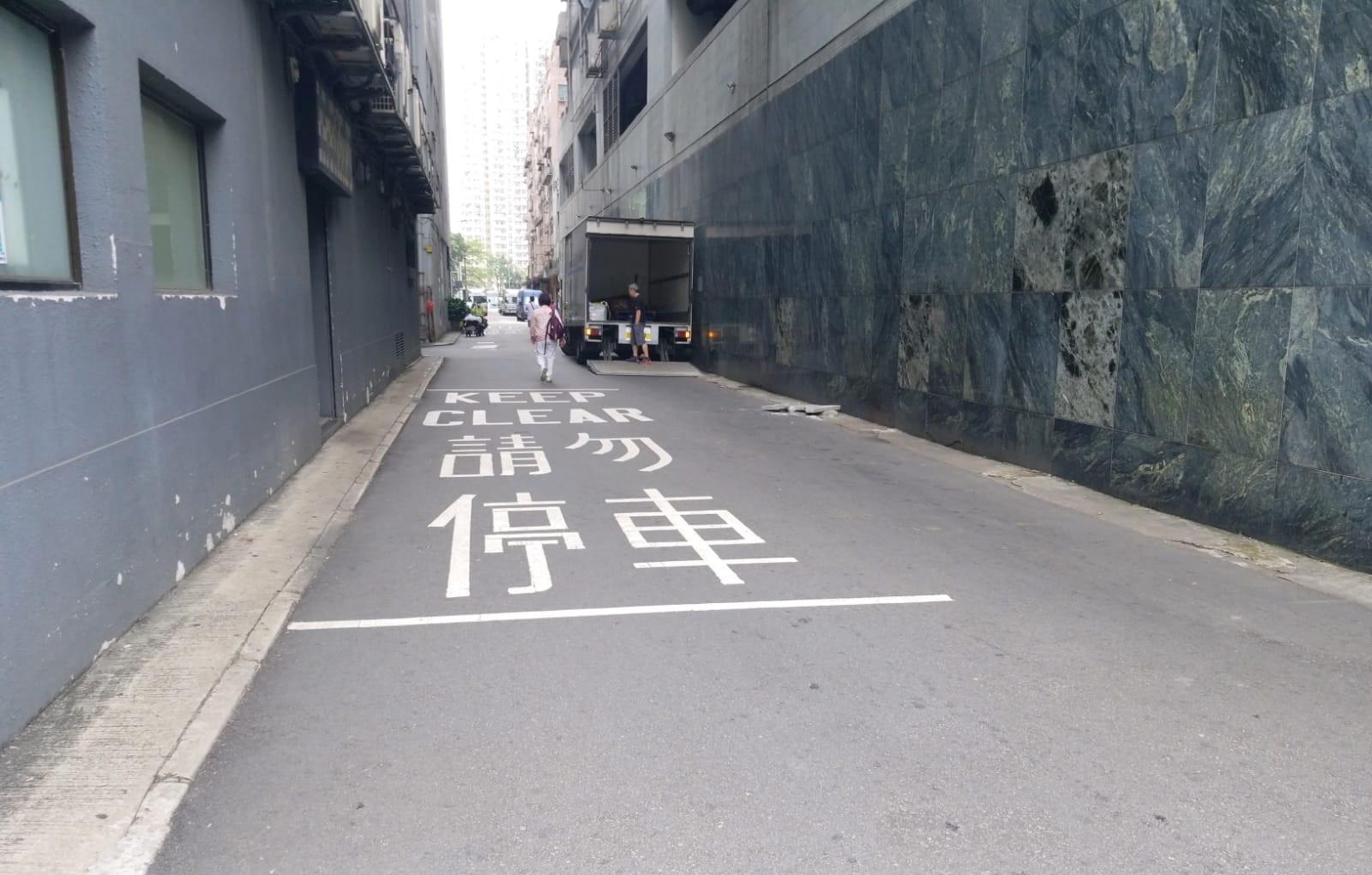
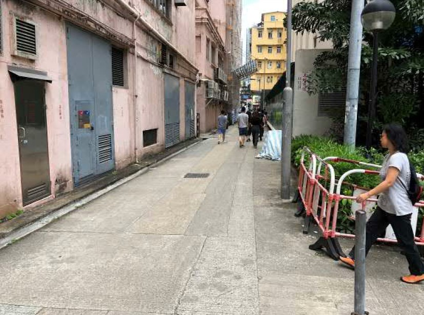
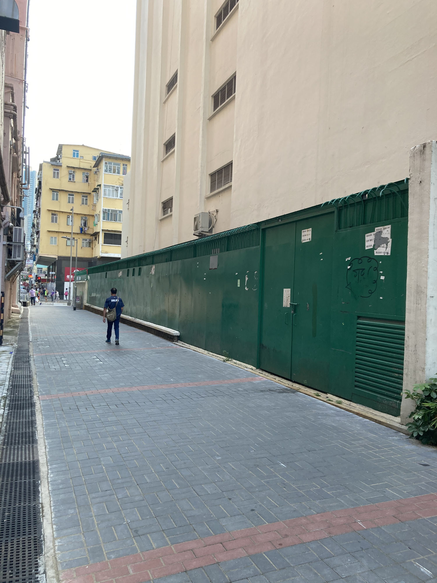
For other back alleys in SPKBA, frequent loading/unloading activities are still observed and these would restrict their potential for face-lifting in the short-term. Subject to further investigation and liaison with the relevant stakeholders, we would suggest resurfacing the carriageways of back alleys.
Streetscape beautification schemes are proposed to -
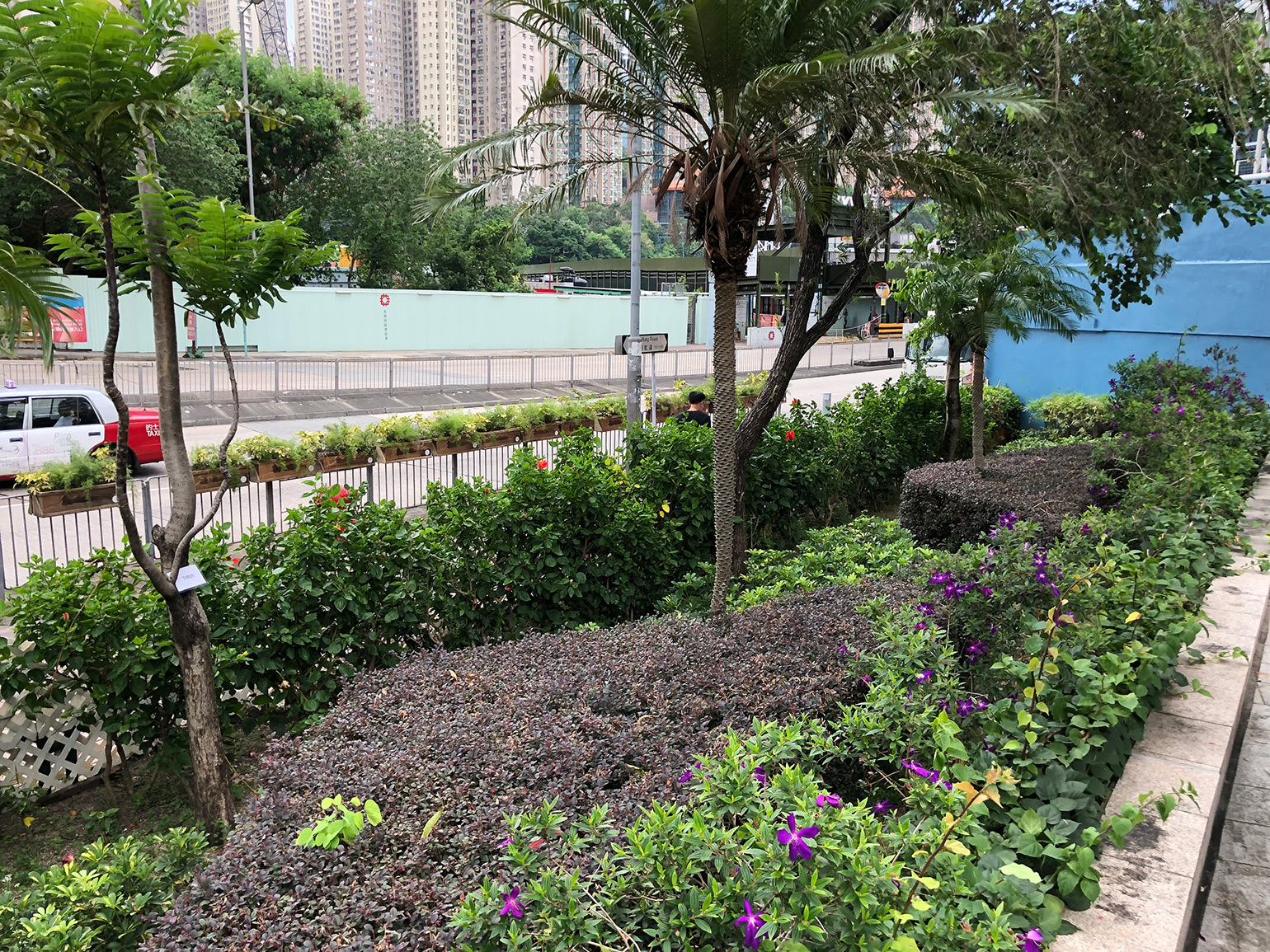
The following strategies are proposed to accord with the landscape objectives for SPKBA:
We propose to re-configure some traffic lanes to enhance the traffic flows in SPKBA. Such improvements would improve the performance of major road junctions and alleviate traffic congestion in the area. The proposed underground public vehicle park at Sze Mei Street would cater for the demand for vehicle parking. Upon completion of the public vehicle park, we recommend reviewing the need to retain the on-street parking spaces in SPKBA with a view to freeing up more road space to increase traffic capacity as necessary.
We also recommend introducing the following smart measures in SPKBA:
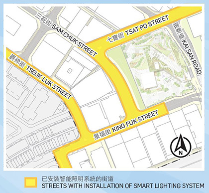
Smart street lighting system allows remote monitoring and control of the on/off conditions of street lights as well as detecting the malfunctioning of individual street lights. It helps to save energy and reduce manpower for monitoring and inspecting street lights. Smart street lighting system has already been installed at some streets in SPKBA (e.g. Tsat Po Street and Tseuk Luk Street).
We recommend exploring further extending the replacement of conventional street lighting with LED lighting and remote lighting level adjustment in SPKBA.
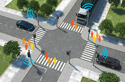
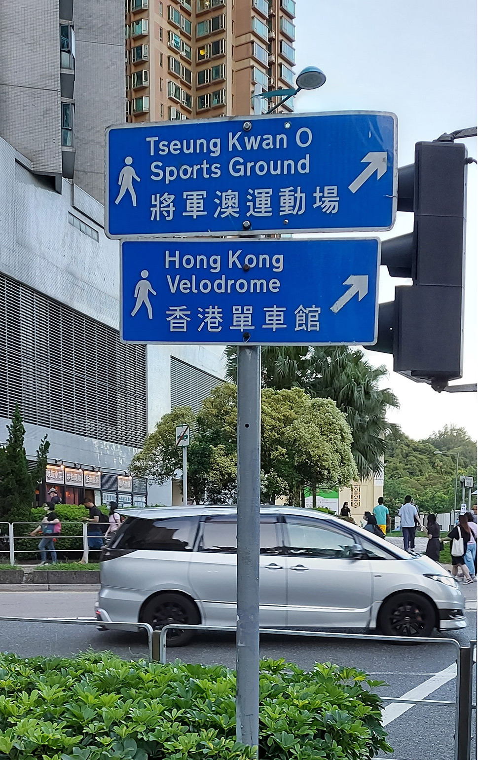
We also recommend exploring installation of intelligent traffic signal system with sensors for pedestrians and vehicles at suitable road junctions to minimize waiting time and enhance safety for both pedestrians and vehicles.
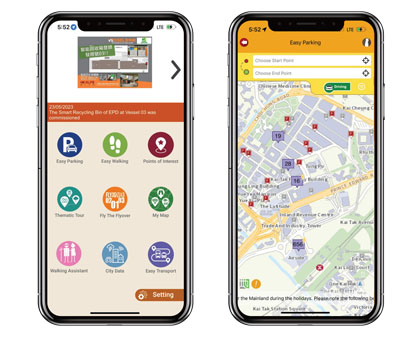
Owners of hourly car parks in SPKBA are invited to join the "Easy Parking" scheme and provide real-time parking vacancy data in the "My Kowloon East" (MyKE) mobile app. This can help drivers to search for vacant parking spaces to reduce unnecessary journeys. With the consent of the data owners, the relevant collected information is shared with Data.Gov.HK, Hong Kong GeoData Store, Common Spatial Data Infrastructure Portal and the Transport Department's HKeMobility app.
The proposed public vehicle park at Sze Mei Street will provide such real-time data in future.
Use of video analytic technology with the support of surveillance cameras to detect illegal parking and deter such activities to help improve traffic conditions in SPKBA. The trial has been completed. Please refer to the following link for more details: https://www.ekeo.gov.hk/en/smart-green-resilient-cbd/smart-city-co-lab/proof-concept-trials/index.html
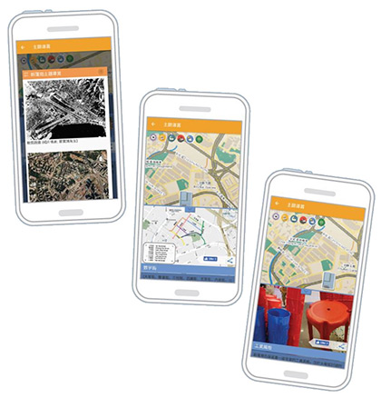
"Easy Walking" function in MyKE Mobile App provides personalized indoor and outdoor routes according to users' needs and preferences, such as sheltered paths, barrier-free paths and suggested walking routes according to real time air quality assessment.
A Thematic Tour function provides thematic walking routes such as San Po Kong Themed Route.
The app also includes other functions such as "Easy Transport" which is a one-stop transport information platform in providing the real-time information of public transport including green minibus, bus and ferry within Kowloon East and San Po Kong Business Area.
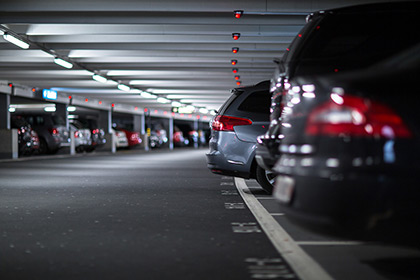
We recommend exploring the possibility of installing smart parking system at the proposed underground public vehicle park at Sze Mei Street.
The study was completed in 2019. The findings of the study are summarized in the executive summary below.